Where to run in and around Cleveland (and beyond)!
Whether you live here or are simply visiting, Cleveland, Tennessee is a treat for runners of all ability levels! From our town’s tried and true Greenway system, to our beautiful donwtown, to the spoil of gorgeous trails and greenway systems within a 30 minute drive, there are ample options for whatever kind of running experience you are looking to have. The following list is simply to help get you started — there are many more trails that could be added to this list! If you have any questions, feel free to stop by Terra Running Company in downtown Cleveland and our friendly staff will be happy to help.
Have a favorite path or trail that didn’t make our list? Let us know in the comments below!
Cleveland/Bradley County Greenway — arguably the best place to run in Cleveland is “the Greenway.” With over 5 miles of unbroken, lighted path along Mouse Creek, the Greenway runs through the heart of Cleveland and through Greenway and Tinsely Parks. Great for out and back runs both long and short, the Greenway has bathrooms and water fountains at various points along the way. For more information and directions to parking and access points, check out their website at http://www.cbcgreenway.com.
Tinsley Park — Tinsley Park is a great access point to the Greenway with bathrooms, water fountains, and the option to head north toward Mohawk Drive, south toward Greenway Park, or east to the Casteel Connector which goes under Keith Street and meets up with Ocoee Street which has a sidewalk until 25th Street. The complex also has dog parks, baseball fields, a swimming pool, pickle ball and tennis courts, etc.
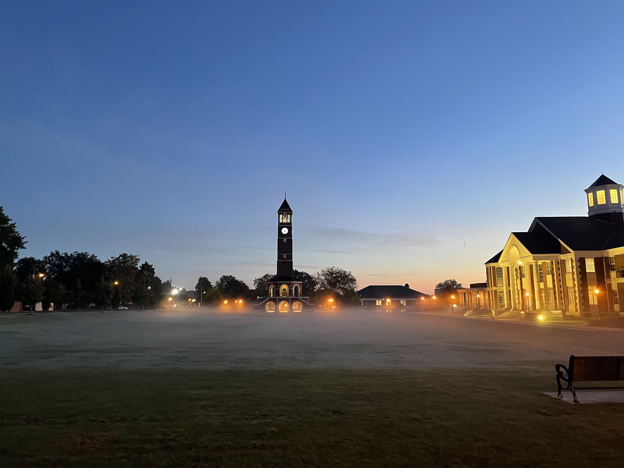
The Lee University Forum at dawn
Greenway Park — Another excellent access point to the Greenway for which it is named, Greenway Park has more bathrooms and water fountains, and is located across from Cleveland High School. Ample parking is available.
Cleveland’s Historic Downtown — Stop by Terra Running Company located at 90 N. Ocoee Street to grab some nutrition before running around downtown and taking in all of the beautiful old brick buildings. Head south down Church Street and run around the Old Woolen Mill, cross back over Inman Street (wait for the stoplight!) and run by the newly renovated Sanda Mill Lofts, come back up First Street and pass First Street Square, and head down into Cleveland’s Historic Neighborhood. Wander down Harle Avenue, pass bustling Deer Park (which has more bathrooms and water), jaunt down Centenary Avenue and take in all of the beautiful homes, before ending your run back at Terra/Cleveland Coffee & Market for some water and a coffee. Not feeling coffee? Meet up with some friends at Mash & Hops or The Press for a post run pint.
Lee University Campus — Running on Lee’s beautiful campus pairs perfectly with a run around Cleveland’s Historic Downtown as they are the same area. Run the length of Parker Street/Paul Conn Parkway to take in most of campus. Run the 1/4 loop around Schimmels Park at the north end of campus before heading back south. Runners can access the Forum loop (the loop of sidewalk in front of Lee’s biggest clocktower) easily from Church Street or climb up the stairs next to the Nursing Building off of Paul Conn Parkway. The Forum loop is a great place to practice speed work or run/walk intervals.
Schimmels Park — Located on the north end of Lee University’s campus, Schimmels Park is a part of the Cleveland/Bradley County Greenway System. Though the park is small with approx. a 1/4 mile of sidewalk, it is serene with large trees, and Mouse Creek running through it. Parking is available though bathrooms are not. Runner’s can access a Greenway extension from Schimmels Park by crossing the crosswalk at 20th Street. The extension will take them on the backside of the Lee University Track (which sadly, is not open to the public) and then under 25th Street. Those wanting a longer run can loop up onto the sidewalk along 25th Street either east or west and head into some more neighborhoods where hills can be found.
Enterprise South Nature Park
Fletcher Park — a beautiful 70 acre park with a 1.5 mile path, Fletcher Park is a great option for those who want the serenity of nature but still want to stick to pavement instead of trails. It is worth noting that the path does get muddy at points so runners will still want to use caution! Restrooms and parking are available.
Johnston Woods — Located a 10 minute drive south of Cleveland off of Highway 11, Johnston Woods is a favorite for those who want to get in a trail run in (or mountain bike ride or hike) but don’t have time to head out to the mountains. A beautiful property owned by Broad Street United Methodist, the church has generously made their trails available to the public. There is also a retreat center and a forest school that operates on the property. Runners can choose the “White Loop” which is approximately 1 mile or the “Blue Loop” which is a little under 3 miles. For a longer run, add both together. There is a porta-potty off of the parking lot but no facilities otherwise. The park closes at dusk.
Enterprise South Nature Park — Located off of Interstate 75 at exit 9 Enterprise Nature Park is a beautiful Hamilton county park built on the grounds of an old dynamite factory (yes, you read that correctly). Stop into the vistors center on your way in for bathrooms and water and read up on the history of the park and the large bunkers that you will see throughout the property. Free park maps are also available to help you navigate which paths you would like to explore, though maps are also posted at various trailheads throughout the park; a number for a park ranger will also be posted. Runners can choose to run on a variety of well-maintained trails or explore the one-way road that goes around the park. This is a busy park so be prepared to share the scenery with bikers, walkers and wildlife.
Southern Adventist White Oak Mt. Trails — Located at the back of Southern Adventist University’s campus in Collegedale, an approximately 30 minute drive from Cleveland, runners will find a beautiful and extensive trail system maintained by the university but open to the public. The trails are well marked and have posted maps throughout, though they are extensive and directionally challenged runners should make sure they are heading down the trail that they intend. Parking (and overflow parking) is available at the trailhead as well as a bathroom and water fountain. Besides runners, these trails are heavily utilized by mountain bikers and hikers.
Tennessee Riverwalk — The Tennessee Riverpark or “Riverwalk” as it is more commonly referred to, is a gorgeous 16.1 mile path along the Tennessee River in beautiful Chattanooga, Tennessee. At it’s northern most point — about a 35 minute drive from Cleveland — the Riverwalk starts at the Chickamauga Dam off of highway 153 and continues south straight into the heart of the city and beyond, ending (or starting) at the Wheland Foundry Station near the base of Lookout Mountain. There are ample access points along the path with parking, bathrooms and water available. The Riverwalk is a favorite of all Chattanoogans so be ready to share the path and the various parks along the way with families, bikers, tourists, fishermen, boaters, and other runners. You won’t be disappointed by a run of any distance on the Riverwalk.
Runner on the Clemmer Trail in the Cherokee National Forest
South Chickamauga Creek Greenway — Connecting directly to the Riverwalk and heading east for 12 miles ending (or starting) at the Camp Jordan sporting complex in East Ridge, Tennessee, the South Chickamauga Creek Greenway is a beautiful path that runs along South Chickamauga Creek. Made up of primarily paved path and wooden boardwalk, this greenway combines natural beauty and functionality as many even use it to commute to work or school — over 30,000 people live within a 10 minute walk of the this greenway system. With a variety of access points that span a variety of Chattanooga neighborhoods and suburbs, this trail is worth a long run.
Clemmer Trail (Cherokee National Forest) — The Clemmer Trail in Cherokee National Forest is a short but beautiful 30 minute drive east of Cleveland. Located at the base of Chilhowee Mountain, there is a small gravel parking lot for runners, bikers and hikers. A trail map is posted but bathrooms and water are not available. Starting at the base of the mountain and heading straight up, this run is not for the faint of heart but if perfect for those who want to get some elevation training. Once at the top of the mountain runners can take a quick hike down to see beautiful Benton Falls or continue to run the variety of trails at the top of the mountain before descending. The trail system on Chilhowee is extensive and perfect for those who are wanting a longer trail running experience. There is also a day use area and campground at the Benton Falls trailhead which has bathrooms (alterantively, runners can drive up to the day use area and start their trail run there for an experience with less elevation gain). Be aware that this is a run in a National Forest where wildlife is abundant. Runners should take precautions in case of an encounter with a bear or poisonous snake (Copperheads or Timber Rattlesnakes) among other things.
Eureka Trail — Heading out of Cleveland in the opposite direction of Chattanooga, the Eureka Trail is located approximately 30 minutes north in Athens, Tennessee. This quiet, flat trail is 4.3 miles of hardpacked gravel that winds through beautiful hardwood forest. The trail is used by runners, hikers, bikers and horseback riders. Following an old rail line that connected Athens and Englewood, Tennessee, the path is named after Eureka Cotton Mill that once operated near the Englewood trailhead. This trail is the site of East Coast Adventures Gone Loco Ultramarathon.


